

| Number of distinct deserts in the US Southwest | 4 major deserts (U.S. Geological Survey) |
| Largest hot desert in North America | Chihuahuan Desert (~200,000 sq mi) (National Park Service) |
| Lushest desert ecosystem | Sonoran Desert (two rainy seasons per year) (Arizona-Sonora Desert Museum) |
| Elevation range across Southwest deserts | -282 ft (Death Valley) to ~7,000 ft (Great Basin) (U.S. Geological Survey) |
| White Sands dune field size | ~275 square miles of gypsum sand (National Park Service) |
| Sedona's approximate elevation | 4,350 feet above sea level |
Four Deserts, Four Distinct Personalities
Most people picture a single generic landscape when they hear "Southwest desert" — but the region actually spans four major North American deserts, each with a radically different character. Understanding these differences transforms how you plan your trip.
| Number of distinct deserts in the US Southwest | 4 major deserts (U.S. Geological Survey) |
| Largest hot desert in North America | Chihuahuan Desert (~200,000 sq mi) (National Park Service) |
| Lushest desert ecosystem | Sonoran Desert (two rainy seasons per year) (Arizona-Sonora Desert Museum) |
| Elevation range across Southwest deserts | -282 ft (Death Valley) to ~7,000 ft (Great Basin) (U.S. Geological Survey) |
| White Sands dune field size | ~275 square miles of gypsum sand (National Park Service) |
| Sedona's approximate elevation | 4,350 feet above sea level |
The Mojave Desert — home to Joshua Tree National Park and Death Valley — sits at higher elevations than its southern neighbors, giving it cooler winters and, famously, the lowest point in North America. Its namesake Joshua trees are found nowhere else on Earth.
The Sonoran Desert stretches across southern Arizona and into Mexico. It's the lushest of the four, receiving two rainy seasons annually. This is saguaro cactus country — Tucson and Saguaro National Park sit squarely in it. Expect a riot of spring wildflowers and surprisingly dense vegetation.
The Chihuahuan Desert, centered in New Mexico and West Texas, is North America's largest hot desert. Big Bend National Park and White Sands National Monument are its headliners. Higher average elevation keeps temperatures more moderate than you might expect.
The Great Basin Desert is technically a cold desert — Nevada, Utah, and parts of Idaho fall within it. Think sagebrush flats, salt pans, and harsh winters. Great Basin National Park offers ancient bristlecone pines and one of the darkest night skies in the country.
Not sure which desert style fits your travel personality? See our guide to matching destinations to travel styles before you book.
Signature Destinations and What Sets Them Apart
Even within a single desert, destinations vary dramatically. Here's how the Southwest's most-visited stops actually differ from one another.
Colorado Plateau
A high desert region covering parts of Utah, Colorado, Arizona, and New Mexico, known for layered sandstone formations, deep canyons, and elevations typically between 5,000 and 11,000 feet.
Saguaro cactus
The iconic, multi-armed cactus native exclusively to the Sonoran Desert. It can live over 150 years and grows only in this specific region of Arizona and northwestern Mexico.
Monsoon season
In the Southwest, a weather pattern from roughly July through September when moisture flows in from the Gulf of Mexico, producing intense afternoon thunderstorms across Arizona and New Mexico.
Gypsum sand
A rare type of white, powdery sand formed from crystallized gypsum minerals. White Sands National Monument is one of the few places on Earth where gypsum dunes exist at this scale.
Cold desert
A desert that experiences cold winters with potential snowfall, distinguishing it from hot deserts. The Great Basin Desert is North America's primary cold desert, dominated by sagebrush rather than cacti.
Timed-entry permit
A reservation system used by popular national parks requiring visitors to book an entry window in advance, reducing overcrowding at peak times.
Sedona, Arizona
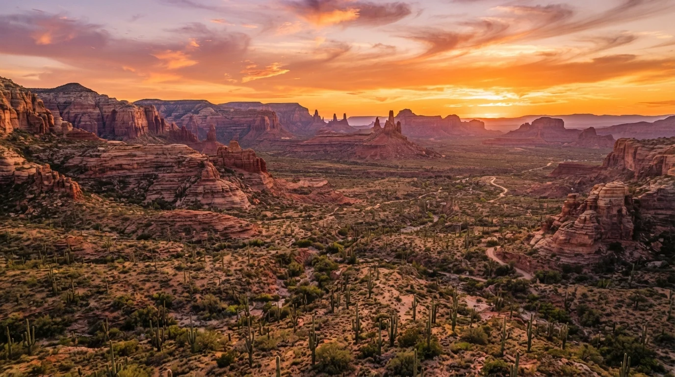
Sedona sits at the edge of the Colorado Plateau where it meets the Sonoran Desert — geologically speaking, it belongs to neither fully. Elevation hovers around 4,350 feet, meaning temperatures run 10–15°F cooler than Phoenix. The red-rock formations here are sandstone sculpted by 300 million years of erosion. Hiking, mountain biking, and stargazing are the core draws; the town also has a well-developed arts scene.
Tucson, Arizona
Tucson is pure Sonoran Desert at its richest. The two "arms" of saguaro cacti surrounding the city in Saguaro National Park (east and west districts) are the symbol of the region. Tucson's food culture — heavily influenced by Sonoran Mexican cuisine — is a travel draw in its own right. Spring (March–April) brings spectacular cactus blooms.
Moab, Utah
Moab is the adventure hub of the Colorado Plateau, flanked by Arches and Canyonlands national parks. It's technically in the Great Basin region but geologically its own world of orange-and-white sandstone arches, spires, and canyon rivers. The Colorado River runs through town, making whitewater rafting a natural addition to any itinerary. See our overview of America's big national parks for deeper trip-planning context.
White Sands, New Mexico
Unique among all Southwestern destinations, White Sands National Monument features 275 square miles of gypsum sand dunes — stark white and visually unlike anything else in North America. It sits in the Chihuahuan Desert at 4,000 feet elevation. Summers are hot but evenings cool sharply; winter visits can bring snow that turns the white dunes surreal.
Verify Conditions Before You Go
Desert conditions — road closures, flash flood risks, permit availability, and park entry requirements — can change quickly and vary by season. Always check the official National Park Service website and relevant state agency pages before finalizing travel plans. Flash floods in canyon areas can occur even when skies appear clear locally.
Planning a road trip that strings several of these together? The family road trip planning guide covers how to structure multi-day drives across large desert stretches without wearing everyone out.
Practical Planning: Climate, Timing, and Safety
Desert travel rewards the prepared. A few key principles apply across all four regions.
110°F+
Typical summer highs in low-elevation Sonoran and Mojave Desert areas
Heat-related illness is a leading cause of visitor incidents in Southwest national parks, according to the National Park Service.
1 liter/hour
Recommended water intake for desert hikers per hour of activity
This is a general guideline widely cited by park rangers and wilderness safety organizations for hot-weather hiking.
150+ years
Potential lifespan of a saguaro cactus in the Sonoran Desert
According to the Arizona-Sonora Desert Museum, saguaros grow slowly and may not sprout their first arm until age 75.
Heat and Hydration
Summer highs in the Sonoran and Mojave deserts regularly exceed 110°F in low-elevation areas. The rule of thumb among desert hikers is to carry at least one liter of water per hour of activity, start hikes before 8 a.m., and turn back before midday heat peaks. Always tell someone your planned route and return time.
Best Seasons by Region
- Sonoran Desert (Tucson, Saguaro): October–April. Avoid July–September monsoon season for hiking, though the thunderstorm light shows are dramatic.
- Mojave (Joshua Tree, Death Valley): November–March. Death Valley in summer is genuinely dangerous for unprepared visitors.
- Colorado Plateau (Moab, Sedona): March–May and September–November. Summer is doable at higher elevations but crowded.
- Chihuahuan Desert (White Sands, Big Bend): October–March for Big Bend; White Sands is year-round but plan for afternoon wind and heat in summer.
Permits and Crowds
Arches National Park now requires timed-entry permits during peak season — check the official National Park Service website well in advance. Many other Southwest parks are following suit. If you prefer genuine solitude, lesser-known state parks in the region often offer comparable scenery without the reservation hassle.